


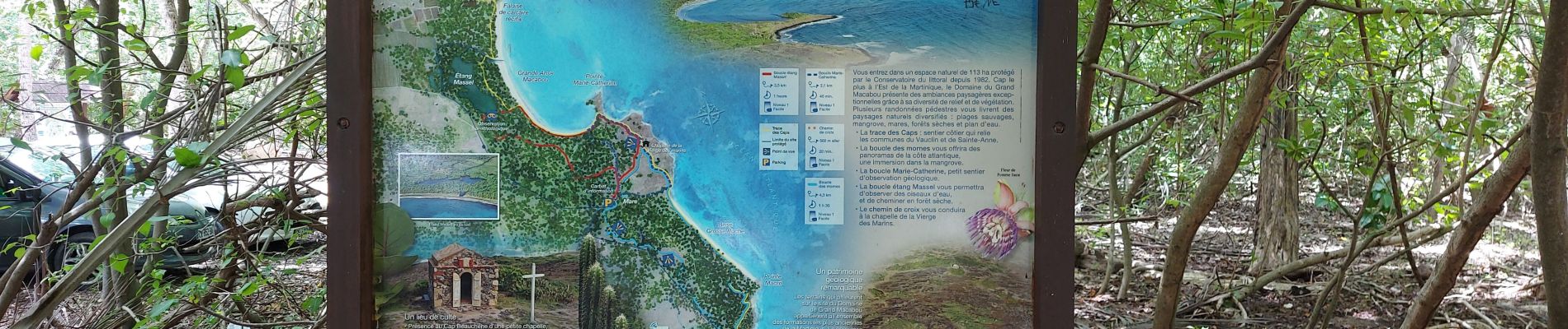
Boucle Macabou via Morne Flambeau

Lamartiniere
User GUIDE
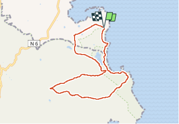

Length
12.5 km

Max alt
133 m

Uphill gradient
249 m
Km-Effort
15.8 km

Min alt
0 m

Downhill gradient
250 m
Boucle
Yes
Creation date :
2022-09-14 11:20:51.942
Updated on :
2022-09-14 15:12:00.996
3h30
Difficulty : Medium

FREE GPS app for hiking
 SityTrail
IGN / Geographical institutes
SityTrail Plus
The world is yours!
About
Trail Walking of 12.5 km to be discovered at Martinique, Unknown, Le Vauclin. This trail is proposed by Lamartiniere.
Photos


21 photos in total. Please click on a photo to see them all in the gallery.
Positioning
Country:
France
Region :
Martinique
Department/Province :
Unknown
Municipality :
Le Vauclin
Location:
Unknown
Start:(Dec)
Start:(UTM)
734471 ; 1605012 (20P) N.
Comments